This is featured post 1 title
Replace these every slider sentences with your featured post descriptions.Go to Blogger edit html and find these sentences.Now replace these with your own descriptions.
This is featured post 2 title
Replace these every slider sentences with your featured post descriptions.Go to Blogger edit html and find these sentences.Now replace these with your own descriptions.
This is featured post 3 title
Replace these every slider sentences with your featured post descriptions.Go to Blogger edit html and find these sentences.Now replace these with your own descriptions.
Showing posts with label Estonia. Show all posts
Friday, 7 October 2011
Hiiumaa
Tahkuna peninsula is the most northern part of Hiiumaa
Hiiumaa (Finnish: Hiidenmaa, German: Dagö, Swedish: Dagö, Danish: Dagø) is the second largest island (989 km²) belonging to Estonia. It is located in the Baltic Sea, north of the island of Saaremaa, a part of the West Estonian archipelago. Its largest town is Kärdla.
Kõpu Lighthouse is one of the best-known landmarks
History
Archaeological evidence of the first human settlement in Hiiumaa dates to as early as the 4th century BC. The first documented record of the island of Dageida was made by contemporary chroniclers in 1228, at the time when Hiiumaa, along with the rest of Estonia, had been conquered by Germanic crusaders. In 1254, Hiiumaa was divided between the Bishopric of Ösel-Wiek and the Livonian branch of the Teutonic Order, who were also partly acting on behalf of the Hanseatic League.
Cars boarding the ferry to mainland at Heltermaa
The island was part of Swedish Estonia from 1563–1720, after which it passed to the Russian Empire as part of the Governorate of Estonia, although Dagö's Swedish population kept most of their privileges. Most of the island's previously numerous Swedish-speaking population emigrated or were "Estonianised" during the period of Imperial Russian rule, although a small minority remains to this day. Estonian Swedes are also known as "aibofolke" (meaning island people in Swedish) or "rannarootslased" (meaning coastal Swedes in Estonian).
Tahkuna lighthouse
Hiiumaa was occupied during World War I by the Imperial German Army, in Operation Albion. After the war, it became a part of independent Estonia. It was annexed by the Soviet Union in 1940, by Nazi Germany in 1941, and by the Soviets again in 1944. It was then a part of the Estonian Soviet Socialist Republic until the Soviet Union's collapse in 1991. Since then, the island has been a part of independent Estonia.
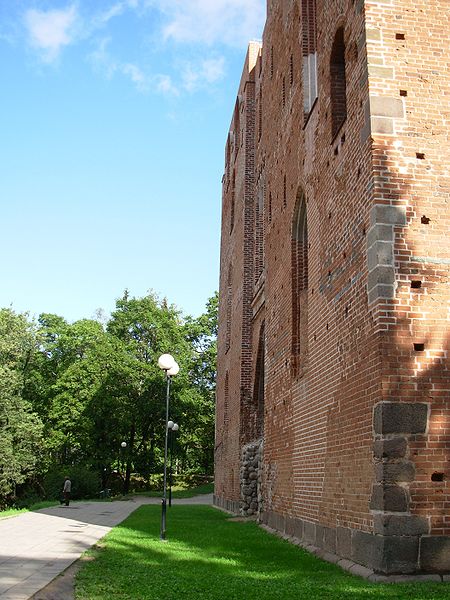
Church of Kassari
Some maritime activities did happen near the waters of Hiiumaa. The Soviet destroyer Gnevny was sunk 23rd June, 1941 after having hit with the German seamine. Two German motor torpedo boats, S43 and S106, were destroyed because of the Soviet seamines, 27th June, 1941. To the north of Hiiumaa, on 1st July, 1941, the Soviet submarine M-81 was destroyed because of a German seamine. On the Hiiumaa waters itself again on 25th June, the Soviet minesweeper T-208 Shkiv was hit with a German seamine and was destroyed. The same happened to the Soviet minesweepers T-216, on 7th July, 1941 and T-201 Zarjad, on 30th July, 1941. Also the Soviet submarine, SC-307, fired a torpedo at the German submarine U-144, which sank, 10th August, 1941.
Old house in Tammela
Transport
Road transport from Estonian mainland to Hiiumaa involves a 90-minute (28 km) ferry crossing from Rohuküla to Heltermaa, which is 25 km by road from Kärdla. There are about 10 ferry departures a day. In the summer weekends, getting car space on the ferry usually requires advance booking. There are about 2 scheduled buses a day between Tallinn (the capital of Estonia) and Kärdla.[3] In the winter, the island can be reached, conditions permitting, via a 26.5 km ice road (the longest in Europe) across the frozen Baltic Sea.
Hiiumaa is served by Kärdla Airport, with regular flights to Tallinn.
Bicycle rental is available in Kärdla and there is a good bicycle path built from Kärdla towards Kõrgessaare.
Sõru museum
Haapsalu
Haapsalu (German and Swedish: Hapsal; Finnish: Haapasalo) is a seaside resort town located on the west coast of Estonia. It's the administrative centre of Lääne County and has a population of 11,618 (as of 1 January 2010).
Haapsalu has been well known for centuries for its warm seawater, curative mud and peaceful atmosphere. Narrow streets with early 20th century wooden houses repeatedly lead to the sea. Haapsalu has been called the "Venice of the North" due to this plenitude of water. The name "Haapsalu" is from Estonian haab 'aspen' and salu 'grove.'
Haapsalu Railway Station, now disused, and notable for the length of its platform canopy.
History
The town dates back to 1279, when it was chartered and became the centre of the Bishopric of Ösel-Wiek, which it remained for the next 300 years. Buildings from those early days remain today, including an episcopal castle which has the largest single-nave cathedral in the Baltic states, Haapsalu Castle.
House in which Peter I of Russia supposedly stayed in 1715
For many years, locals have claimed that the sea mud has a curative effect. A military doctor, Carl Abraham Hunnius, founded the first mud cure resort in 1825. News of the curative mud quickly reached the aristocracy of Saint Petersburg, the capital of the Russian Empire. Ever since then, Haapsalu has been a popular summer destination where people from all around the world come for medical treatment. Today, there are three mud cure establishments in Haapsalu varying in size and location.
Haapsalu and the surrounding area was the center for the Swedish population in Estonia from the 13th century until the evacuation of almost all ethnic Swedes from Estonia in 1944.
In the 19th century, Haapsalu became famous for its shawls, a delicate craft made by local women. The Land of Ilon Wikland (Wiklandia), a recreation centre for children, is set to open in a few years within the town. This world famous book illustrator has been involved with Haapsalu since her childhood. The August Blues Festival is held every August in Haapsalu.
During the Cold War, Haapsalu Air Base, southwest of the town, was home to an interceptor aircraft regiment.
Viljandi
Viljandi town hall
Viljandi (German: Fellin) is a town and municipality in southern Estonia with a population of 19,150 (2011). It is the capital of Viljandi County. The town was first mentioned in 1283, upon being granted its town charter by Wilhelm von Endorpe.
St. John's church
In 1211 the hill-fort of the Estonians in Viljandi was besieged by a joint army of Germans, Latvians, and Livs. The Livonian Sword Brethren captured the hill-fort in August 1223 from a contingent of the people of Rus, who joined forces with the insurgent Estonians. The following year the Grand Master Volquin led the construction of the castle at the site of the former hill-fort. The Viljandi (Fellin) castle was one of the largest in the Baltic region. It was a major fortification of the Livonian Order and was appointed a commander from 1248. The fortress was continually rebuilt and modernized over the next two-hundred years.
St. Paul's church
In 1283, the town received a charter from Wilhelm von Endorpe, the master of the Order. The town became a member of the Hanseatic League at the beginning of the 14th century, and is one of five Estonian towns and cities in the league.
In 1470, Johann Wolthus von Herse, then master of the order, took up residence in the castle. In 1481, Ivan III of Russia laid siege to the castle but could not take it. However, during the Livonian War, Muscovite Russia succeeded in seizing it in 1560. During the Polish–Swedish War at the beginning of the 17th century the castle changed hands several times and fell into ruins. The same goes for the town, which was deprived of its privileges.
After the Great Northern War the Russians revoked local autonomy until 1783, when in the course of the regency reforms of the Empress Catherine the Great Viljandi became a district town. This involved the re-establishment of town bylaws. The economic and political importance of Viljandi started to increase. The population, after decreasing in population and wealth, started to rise again, as handicraft, trading, and cultural life were revived.
The popular Estonian newspaper Sakala was founded in Viljandi in 1878.
Symbols
The flag of Viljandi is bi-coloured, its upper part light blue and lower part white. The city's shield-shaped coat of arms is light blue, with a white rose in the middle. Viljandi is the white rose city – in midsummer there are 720 white roses flowering in front of the city hall, planted for the town's anniversary in 2003. In summer, the White Rose Day is celebrated in Viljandi.
Culture
Viljandi is sometimes called the cultural capital of Estonia, partly due to the Viljandi Culture Academy being located there.
In Viljandi, several international festivals and other cultural events take place: Viljandi Folk Music Festival, The Early Music Festival, Hansa Days, Young Dance Festival, Winter Folk Dance Festival, the "Theatre in Suitcase" puppet theatre festival, and others.
Since 1920, Viljandi has had the Ugala drama theatre. The tradition of open-air performances dates back to the same year. The Viljandi Puppet Theatre also works there.
In 2002, a new library was built, which is also a venue for exhibitions, meetings with famous people, culture seminars, etc. There are several exhibition halls and galleries in Viljandi. A meeting place for artistic people is the Kondas Centre, dedicated to Estonian naïve artist Paul Kondas.
Viljandi is famous for Viljandi Folk Music Festival – a music festival with a focus on European folk music. It is traditionally held in the end of July. In the year 2006, over 24,000 people attended the concerts. As such, it is the largest annual music festival in Estonia. Due to this, Viljandi is sometimes called the Estonian Capital of Folk Music. A manor house on Kirsimägi in the Castle ruins was restored and holds the Estonian Traditional Music Center (or Traditional Music Storehouse). The mission of the Center is to promote and teach traditional music.
Tartu
Tartu is the second largest city of Estonia. In contrast to Estonia's political and financial capital Tallinn, Tartu is often considered the intellectual and cultural hub, especially since it is home to Estonia's oldest and most renowned university. Situated 186 km southeast of Tallinn, the city is the centre of southern Estonia. The Emajõgi river, which connects the two largest lakes of Estonia, crosses Tartu. The city is served by Tartu Airport.
University of Tartu main building.
Historical names of the town include Tarbatu, an Estonian fortress founded in the 5th century,[3] Yuryev (Юрьев) named c. 1030 by Yaroslav I the Wise, and Dorpat as first known by the German crusaders in the 13th century.
Rüütli street in historical midtown Tartu.
Climate
Tartu lies within the temperate humid continental climate zone. The climate is rather mild considering the high latitude, largely due to the proximity of the Baltic Sea and warm airflows from the Atlantic. Nevertheless, continental influence can be felt on hot summer days and cold spells in winter, when temperature can occasionally (but rarely) drop below −30 °C (−22 °F). Generally, summers are cool to warm and winters are cold, although very mild and rainy in recent years.
Town Hall, built in 1786.
Main sights
The architecture and city planning of historical Tartu mainly go back to the pre-independence period, with Germans forming the upper and middle classes of society, and therefore contributing many architects, professors and local politicians.
The fountain "Kissing Students" (Estonian: Suudlevad Tudengid) reminds visitors that the University of Tartu and its students have a profound effect on life in Tartu
Most notable are the old Lutheran St. John's Church (Estonian: Jaani Kirik, German: Johanneskirche), the 18th-century town hall, the university building, ruins of the 13th-century cathedral, the botanical gardens, the main shopping street, many buildings around the town hall square and Barclay Square.
St. John's Church
The historical slum area called Supilinn (Soup Town) is located on the bank of river Emajõgi, near the town centre and is regarded as one of the few surviving "poor" neighbourhoods of 19th century Europe. At the moment Supilinn is being rapidly renovated, undergoing a slow transformation from the historic slum into a prestigious high-class neighborhood. The active community embodied by the Supilinn Society is committed to preserving the heritage.
Tartu University main building
The Second World War destroyed large parts of the city centre and during the Soviet occupation many new buildings were erected – notably the new Vanemuine Theater. The effects of the war are still witnessed by the relative abundance of parks and greenery in the historic centre. In the suburbs, classic Soviet neighbourhoods – blocks of high-rise flats – were built during the period between WW2 and restoration of Estonian independence in 1991.
University of Tartu Botanical Gardens
Presently, Tartu is also known for several modern, rather sterile-looking buildings of the "steel, concrete and glass" variation, but has managed to retain a healty mix of old and new buildings in the centre of town.
Tartu's large student population means that it has a comparatively thriving nightlife, with many bars, restaurants, and nightclubs. Popular meeting place is, for example, the Gunpowder Cellar (Püssirohukelder) near the Tartu Cathedral.
Historical market building
Annually, in the summer, Tartu hosts the Hansa Days Festival (Estonian: Hansapäevad) to celebrate the Hanseatic heritage under the motto "History lives" when the old town bustles with activity from handicraft markets and historic workshops to a jousting tournament.
Cathedral ruins Angel's Bridge at dusk in winter In front of the University Cafe Hanseatic Days celebration Barclay Square Emajõe Centre commercial building. |
04:28
homesweethome


