 03:47
03:47
 homesweethome


The Nile in Egypt
The Nile (Arabic: النيل, An Nīl, Ancient Egyptian Iteru or Ḥ'pī, Coptic ⲫⲓⲁⲣⲱ Piaro or Phiaro, Amharic: ዓባይ?; transliterated: ʿAbbai, but pronounced Abbai) is a major north-flowing river in North Africa, generally regarded as the longest river in the world.[3] It is 6,650 km (4,130 miles) long. It runs through the eleven countries of Sudan, South Sudan, Burundi, Rwanda, Democratic Republic of the Congo, Tanzania, Kenya, Ethiopia, Eritrea, Uganda and Egypt.
The Nile at Dendera, as seen from the SPOT satellite
The Nile has two major tributaries, the White Nile and Blue Nile. The latter is the source of most of the water and fertile soil. The former is the longer. The White Nile rises in the Great Lakes region of central Africa, with the most distant source being as-yet undetermined, and located in either Rwanda or Burundi. It flows north through Tanzania, Lake Victoria, Uganda and South Sudan. The Blue Nile starts at Lake Tana in Ethiopia at 12°02′09″N 037°15′53″E / 12.03583°N 37.26472°E / 12.03583; 37.26472 and flows into Sudan from the southeast. The two rivers meet near the Sudanese capital of Khartoum.

The Nile near Beni Suef
The northern section of the river flows almost entirely through desert, from Sudan into Egypt, a country whose civilization has depended on the river since ancient times. Most of the population and cities of Egypt lie along those parts of the Nile valley north of Aswan, and nearly all the cultural and historical sites of Ancient Egypt are found along riverbanks. The Nile ends in a large delta that empties into the Mediterranean Sea.
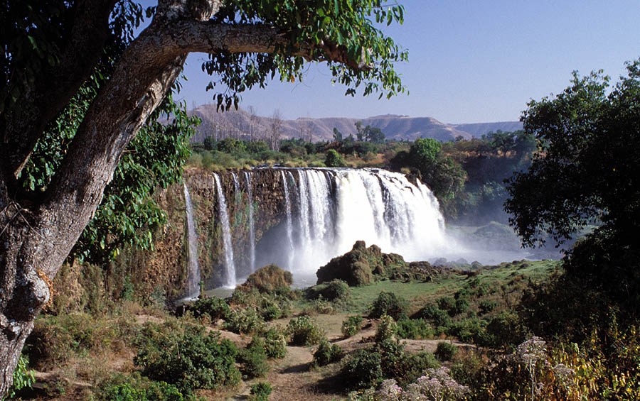
The Blue Nile Falls fed by Lake Tana near the city of Bahir Dar, Ethiopia
Course
Above Khartoum the Nile is also known as the White Nile, a term also used in a limited sense to describe the section between Lake No and Khartoum. At Khartoum the river is joined by the Blue Nile. The White Nile starts in equatorial East Africa, and the Blue Nile begins in Ethiopia. Both branches are on the western flanks of the East African Rift, the southern part of the Great Rift Valley.

Nile Delta from space
The drainage basin of the Nile covers 3,254,555 square kilometres (1,256,591 sq mi), about 10% of the area of Africa. The Nile basin is complex, and because of this, the discharge at any given point along the mainstem depends on many factors including weather, diversions, evaporation and evapotranspiration, and groundwater flow.
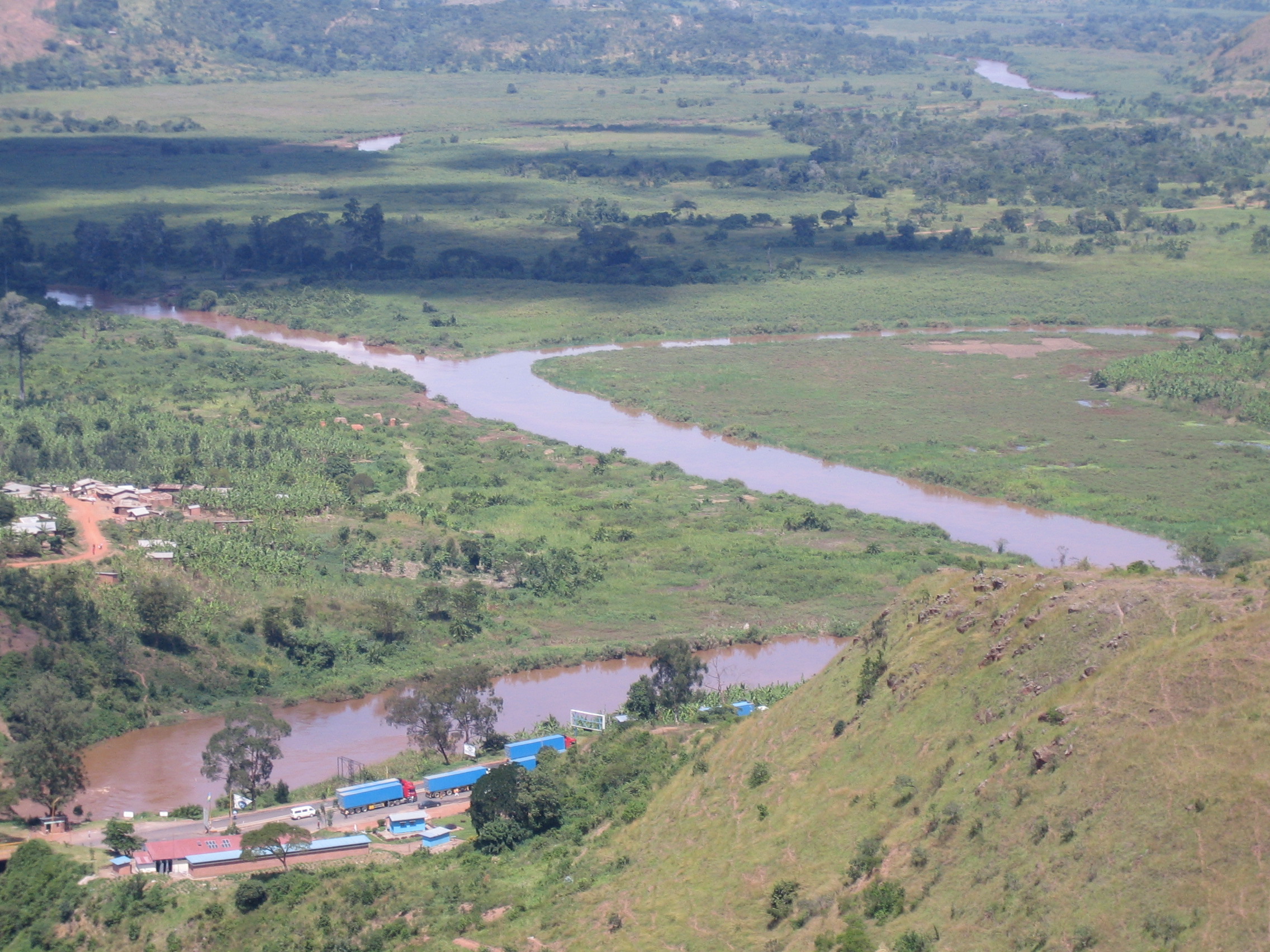
The confluence of the Kagera and Ruvubu rivers near Rusumo Falls, part of the Nile's upper reaches
Source
The source of the Nile is sometimes considered to be Lake Victoria, but the lake has feeder rivers of considerable size. The Kagera River, which flows into Lake Victoria near the Tanzanian town of Bukoba, is the longest feeder, although sources do not agree on which is the longest tributary of the Kagera and hence the most distant source of the Nile itself. It is either the Ruvyironza, which emerges in Bururi Province, Burundi, or the Nyabarongo, which flows from Nyungwe Forest in Rwanda. The two feeder rivers meet near Rusumo Falls on the Rwanda-Tanzania border.
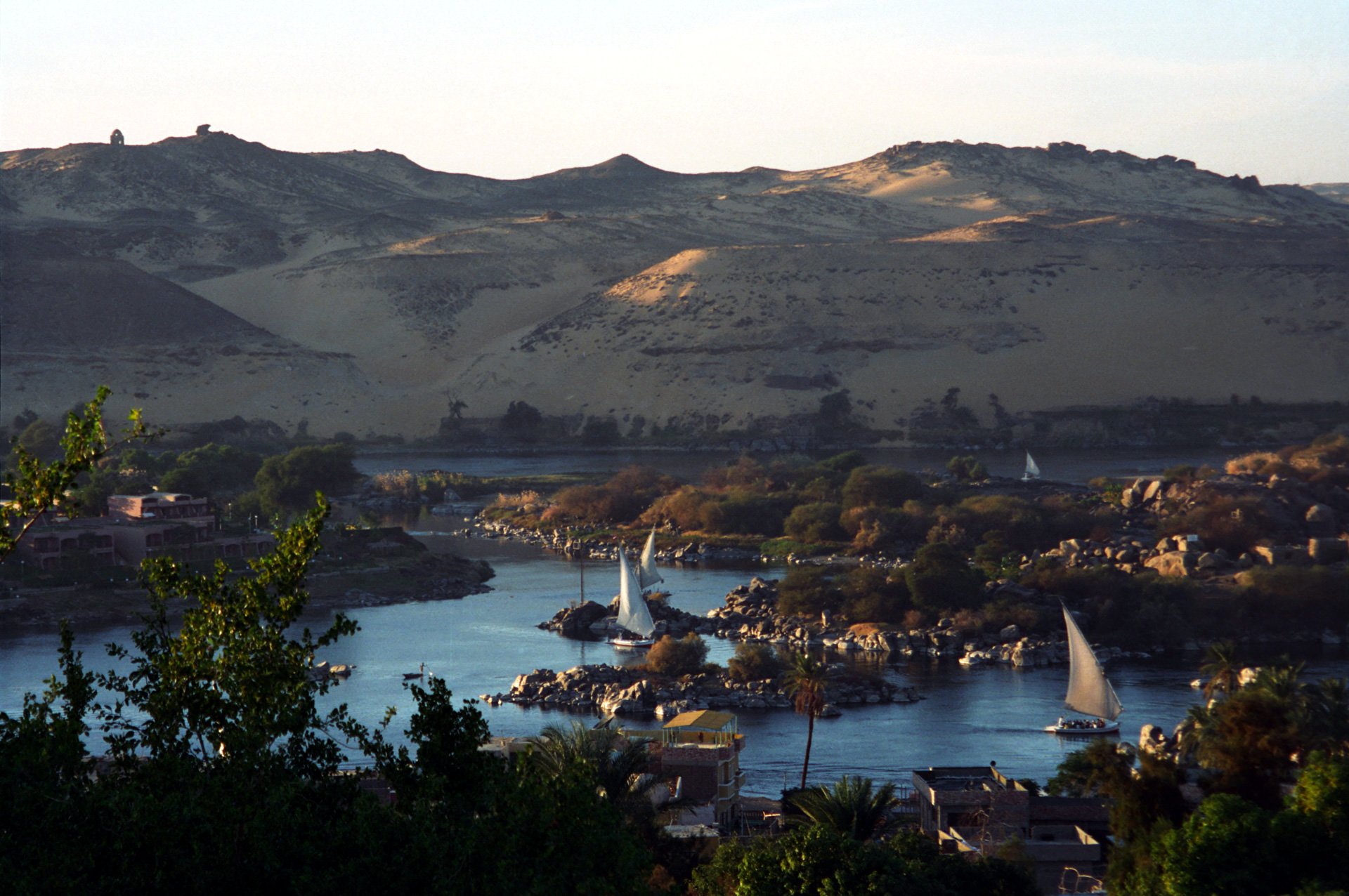
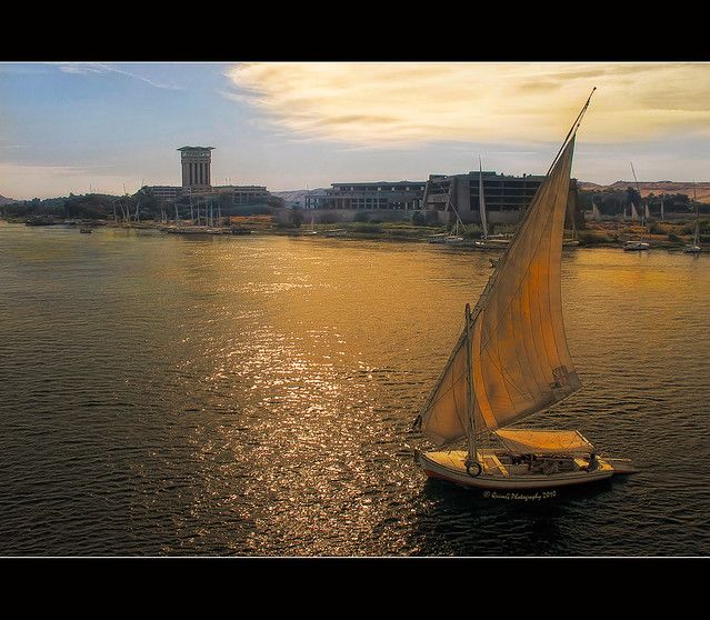
Dhows on the Nile
Lost headwaters
Formerly Lake Tanganyika drained northwards along the African Rift Valley into the Albert Nile, making the Nile about 900 miles (1,400 km) longer, until blocked in Miocene times by the bulk of the Virunga Volcanoes.
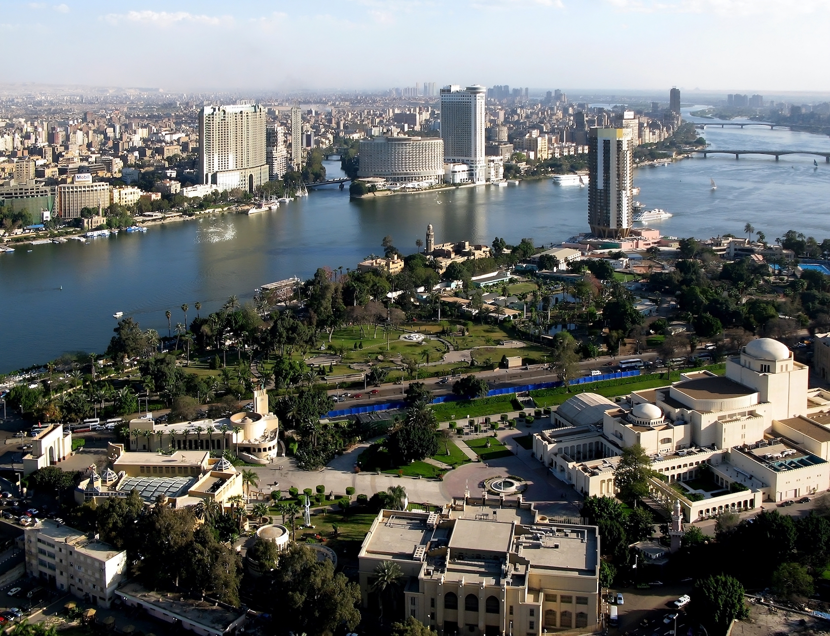
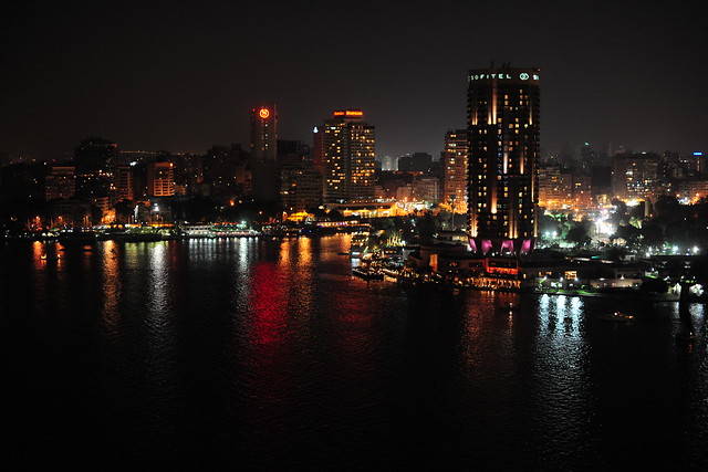
The Nile passes through Cairo, Egypt's capital city

In Uganda
The Nile leaves Lake Victoria at Ripon Falls near Jinja, Uganda, as the Victoria Nile. It flows for approximately 500 kilometres (300 mi) farther, through Lake Kyoga, until it reaches Lake Albert. After leaving Lake Albert, the river is known as the Albert Nile.

In South
SudanIt then flows into South Sudan, where it is known as the Bahr al Jabal ("River of the Mountain"). The Bahr al Ghazal, itself 716 kilometres (445 mi) long, joins the Bahr al Jabal at a small lagoon called Lake No, after which the Nile becomes known as the Bahr al Abyad, or the White Nile, from the whitish clay suspended in its waters. When the Nile flooded it left a rich silty deposit which fertilized the soil. The Nile no longer floods annually since the completion of the Aswan Dam in 1970. An anabranch river, the Bahr el Zeraf, flows out of the Nile's Bahr al Jabal section and rejoins the White Nile.
The flow rate of the Bahr al Jebal at Mongalla, South Sudan is almost constant throughout the year and averages 1,048 m3/s (37,000 cu ft/s). After Mongalla, the Bahr Al Jabal enters the enormous swamps of the Sudd region of South Sudan. More than half of the Nile's water is lost in this swamp to evaporation and transpiration. The average flow rate of the White Nile at the tails of the swamps is about 510 m3/s (18,000 cu ft/s). From here it soon meets with the Sobat River at Malakal. On an annual basis the White Nile upstream of Malakal contributes about 15% of the total outflow of the Nile River.

The average flow of the White Nile at Malakal, just below the Sobat River, is 924 m3/s (32,600 cu ft/s); the peak flow is approximately 1,218 m3/s (43,000 cu ft/s) in October and minimum flow is about 609 m3/s (21,500 cu ft/s) in April. This fluctuation is due the substantial variation in the flow of the Sobat, which has a minimum flow of about 99 m3/s (3,500 cu ft/s) in March and a peak flow of over 680 m3/s (24,000 cu ft/s) in October.[12] During the dry season (January to June) the White Nile contributes between 70% and 90% of the total discharge from the Nile.
In Sudan
Below Renk the White Nile enters Sudan, where it flows north to Khartoum and meets the Blue Nile.
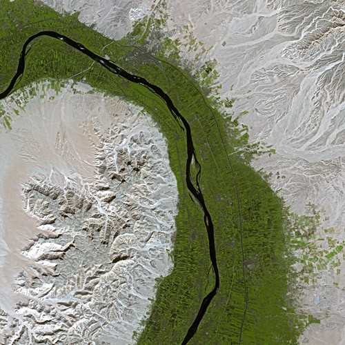
The course of the Nile in Sudan is distinctive. It flows over six groups of cataracts, from the first at Aswan to the sixth at Sabaloka (just north of Khartoum) and then turns to flow southward before again returning to flow north. This is called the Great Bend of the Nile.
In the north of Sudan the river enters Lake Nasser (known in Sudan as Lake Nubia), the larger part of which is in Egypt.
In Egypt
Below the Aswan High Dam, at the northern limit of Lake Nasser, the Nile resumes its historic course.
North of Cairo, the Nile splits into two branches (or distributaries) that feed the Mediterranean: the Rosetta Branch to the west and the Damietta to the east, forming the Nile Delta.
 Posted in: EGYPT


0 意見:
Post a Comment